
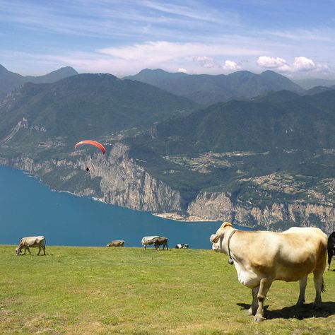
With its mountains and the largest lake in Italy, the Lake Garda region is just the perfect place for a fantastic hike. In addition to the diverse nature, which can show off above all with mountains, Mediterranean flora and fauna, and the mild climate, the region is bursting with hiking trails and outdoor opportunities.
You can hike, mountain bike, or enjoy the breathtaking view of Lake Garda with a glass of wine in one of the small and picturesque villages such as Malcesine. Here are the top 5 entertaining hiking trails with the most beautiful views on Lake Garda:
Malcesine: Easy hike to Chiesa San Michele
This picturesque little village of Malcesine lies between Lake Garda and the majestic crest of Monte Baldo mountain. If you want to combine a visit to this jewel in the Italian region of Veneto with a hike, you can easily combine both with this round trip to the Chiesa di San Michele above the village.
The short hike is worthwhile, even in bad weather. The almost one-hour climb is rewarded with a breathtaking panorama of Malcesine and the famous Scaliger castle. At sunset, the village turns into a sea of lights mysteriously reflected in Lake Garda’s water.
- Start: in front of the valley station of the Monte Baldo cable car (85 meters)
- Length: around 8 kilometers
- Duration: 2 hours
- Altitude difference: 525 meters
- Difficulty level: easy
- Best season: March to November
- Good to know: Can also be walked on with sneakers
Pai di Sopra: hike to San Giovanni di Brenzone
Olive groves and the Mediterranean flair make the landscape in the Italian region of Verona a picturesque natural backdrop. The hike from Pai di Sotto to San Giovanni di Brenzone high above Lake Garda leads past old hamlets and lonely farmsteads until you finally reach the village of Campo di Brenzone.
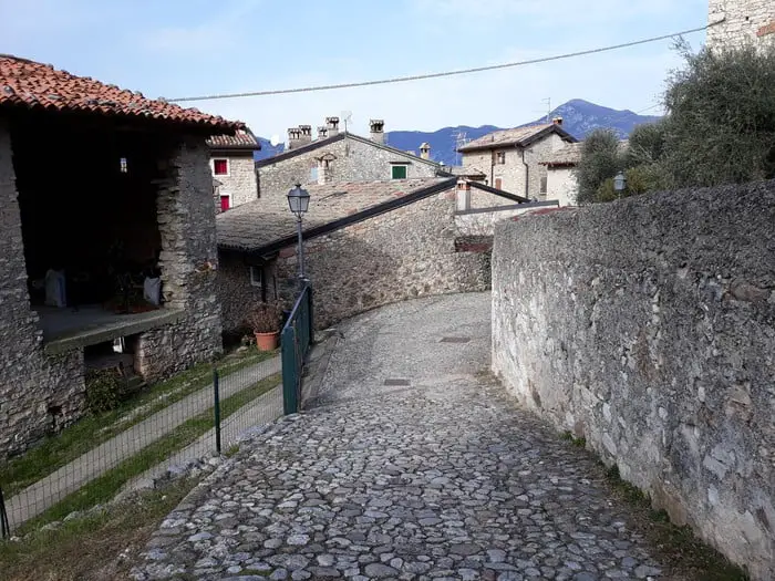
The medieval town seems to have stood still at another time. Nobody lives there anymore. The chapel of San Pietro in Vincoli, which was built in the 14th century, is located on the outskirts of the settlement and is worth a visit with its unique coloring and striking features.
- Start: Park in Pai di Sopra on Via Carducci
- Length: around 10 kilometers
- Duration: 4 hours
- Altitude difference: 630 meters
- Difficulty level: easy
- Best season: March to September
- Good to know: You can stop off at the village of Pai
Gardola: to the waterfalls in the forests of Tignale
This enjoyable hike leads through forests, deep gorges, and partly on narrow paths to the refreshing waterfalls in the forests of Tignale on Lake Garda. The hike starts easily, but it becomes a little more demanding in the middle section, with a few difficult spots secured with ropes.
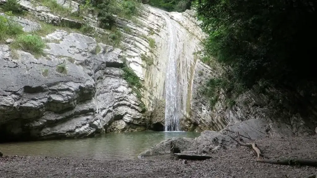
There are several waterfalls along the road, which appear entertaining with their varied landscape. In summer, when there are hot temperatures, the cold water lures. Rest with a short jump into the water should therefore not be missed.
- Start: Gardola parking lot
- Length: around 5 kilometers
- Duration: an hour and a half
- Altitude difference: 148 meters
- Difficulty level: easy-medium
- Best season: May to September
- Good to know: Children can go too, but they should have a certain level of sure-footedness because you come across steep stairs, which are secured with ropes.
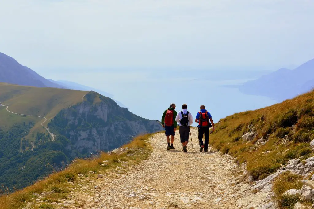
Monte Baldo: Hike on the “Sentiero del Ventrar”
Picturesque gorges, barren rocks, and always Lake Garda in view. This hike in the Garda mountains on Monte Baldo in the Veneto region has everything a hiking heart wishes. The path leads along narrow roads, and sometimes the difficult spots are also equipped with wire ropes.
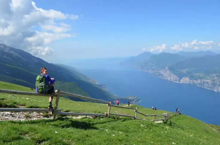
But the picturesque pastures, Lake Garda, and the distant view of the Veneto plain help you quickly forget the hardships. Besides, the trail is full of vantage points where you can recharge your batteries. You should carefully look at the markings because some of them are painted on a rock.
- Start: in front of the valley station of the Monte Baldo cable car (85 meters)
- Length: around 5 kilometers
- Duration: 2 hours
- Altitude difference: 314 meters
- Difficulty level: medium
- Best season: June to October
- Good to know: In the summer months, because of the large number of visitors, it is advisable to go earlier to the Monte Baldo cable car station to start the climb at the time
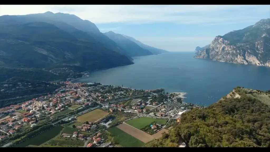
Riva del Garda: hike to Monte Brione
On a section of the “Sentiero della Pace,” you will go towards Monte Brione, an elevation at the northern end of Lake Garda. Although it does not appear to be very high at 376 meters, its height is sufficient to enjoy a unique panoramic view of the surrounding places such as Riva del Garda and Nago-Torbole from its summit.
This short hike to Monte Brione is entertaining and something for romantic souls. Because in the dusk, when the sky turns pink and red, Lake Garda’s view is remarkable.
- Start: Riva del Garda, chargeable parking at the boat harbor San Nicolò
- Length: 5.5 kilometers
- Duration: around 2 hours
- Altitude difference: 315 meters
- Difficulty level: medium
- Best season: June to October
- Good to know: If you are coming to Monte Brione at dusk, don’t forget hand lamps

Check out more articles about Lake Garda:
- Best restaurants with a view in Lake Garda
- Islands in Lake Garda
- Best Lake Garda Towns
- Best months to visit Lake Garda
- Best Airbnb in Lake Garda
- Is Lake Garda worth visiting?
- Is Lake Garda expensive?

